Volcano profile · Negros Island, Philippines
Kanlaon
The highest volcano on Negros — an active stratovolcano capable of sudden summit explosions, ash emissions, pyroclastic density currents and destructive lahars.
Latest activity and alert level
Check the live status hub
Kanlaon can change rapidly between quiet intervals, ash emissions and explosive activity. View the Volcoholics volcano directory for the latest verified official position from DOST-PHIVOLCS.
View latest Kanlaon status →Negros Island's volcanic summit
A broad volcanic complex with an active southern vent
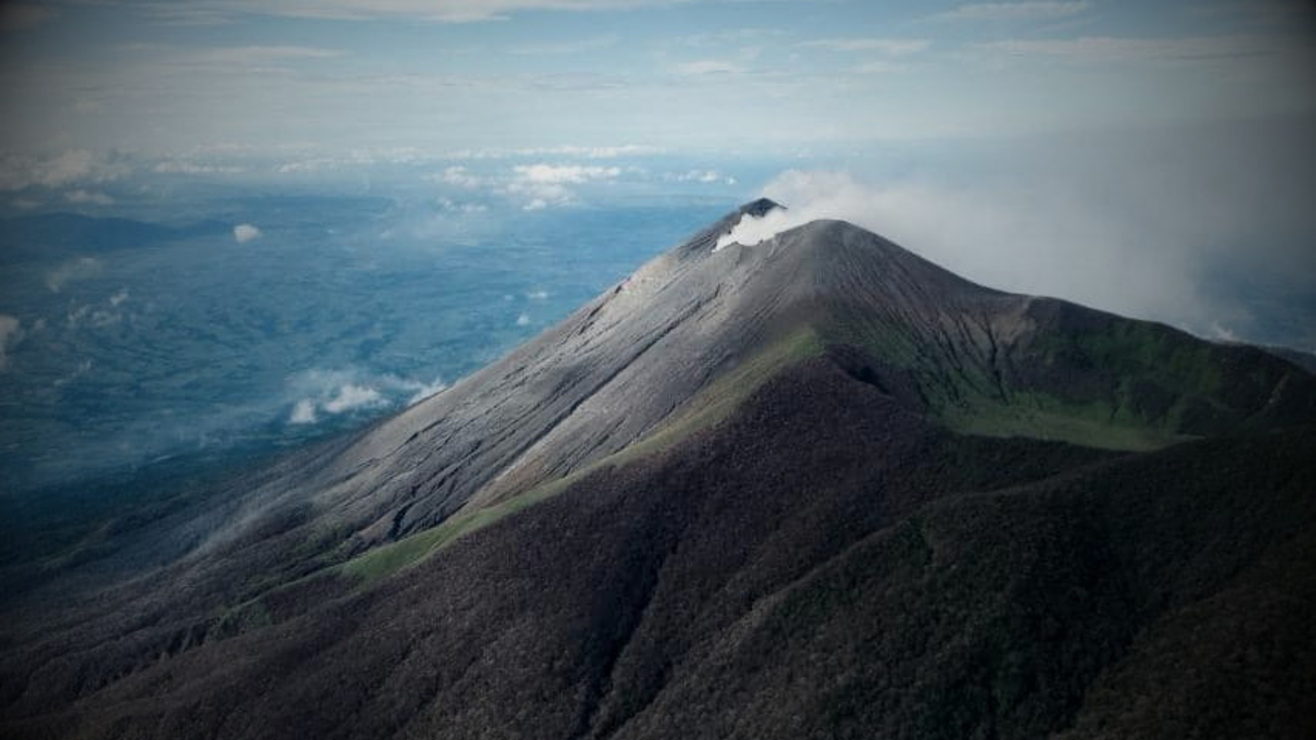
Kanlaon rises to about 2,422 metres and forms the highest point on the Philippine island of Negros.
The volcano is more complex than a single perfect cone. Its summit contains an elongated northern caldera and a smaller, higher active vent to the south, while fissure-controlled pyroclastic cones and craters mark the wider edifice.
Historical eruptions have often been small-to-moderate explosive events, but recent activity has also demonstrated the ability to generate substantial ash columns and pyroclastic density currents.
2,422 mSummit elevation
StratovolcanoVolcano type
Permanent Danger Zone4 km radius
PHIVOLCSOfficial monitoring
Kanlaon quick facts
- Volcano type
- Stratovolcano / caldera complex
- Location
- Negros Island, Philippines
- Summit elevation
- About 2,422 metres
- Active summit vent
- Lugud crater
- Official agency
- DOST-PHIVOLCS
Activity and behaviour
Explosions, ash and rapidly changing summit conditions
Evergreen profile
How Kanlaon behaves
Kanlaon commonly produces ash-rich explosive activity from its summit vent. Stronger events can generate high eruption columns, ballistic ejecta and pyroclastic density currents that descend the upper flanks.
Check the latest verified status →Characteristic activityExplosive eruptionsMany historical events have been phreatic or ash-rich
Active summit ventLugud craterThe smaller, higher southern summit vent
Proximal hazardBallistic ejectaSudden explosions threaten the summit area
Escalation hazardPyroclastic currentsColumn collapse can send hot material downslope
Official sourcePHIVOLCSAuthoritative alerts, bulletins and hazard guidance
A permanent summit exclusion
The 4-kilometre Permanent Danger Zone
PHIVOLCS designates a four-kilometre radius Permanent Danger Zone around Kanlaon. Sudden explosions, ballistic fragments, ash and fast-moving pyroclastic material can make the summit and upper flanks dangerous even when activity appears limited.
Summit architecture
More than one crater at the top of Negros
Kanlaon’s summit is a volcanic complex, not a single simple crater.
The summit contains an elongated northern caldera roughly two kilometres wide, including a crater lake, while the smaller but higher Lugud crater lies to the south and forms the active summit vent.
Northern calderaAn elongated summit depression containing a crater lake.
Lugud craterThe higher southern crater and active eruptive vent.
Fissure conesPyroclastic cones and craters occur across the wider edifice.
Steep drainagesValleys channel ash-rich currents and rain-remobilised sediment.

How Kanlaon erupts
From pressurisation to ash, currents and lahars

Monitoring
Reading a complex summit through multiple signals
PHIVOLCS combines seismic, deformation, gas, visual and thermal observations because Kanlaon’s explosions can arise from different processes and can escalate quickly.
SeismicityVolcanic earthquakes and tremor reveal movement and pressurisation.
Ground deformationTilt and geodetic measurements track inflation and deflation.
GasSulfur dioxide measurements help reveal degassing behaviour.
Visual camerasPlumes, ash emissions and summit changes are tracked remotely.
Thermal observationsInfrared data can reveal hot material and enhanced degassing.
Rainfall / channelsWeather matters because loose deposits can become lahars.
A volcano through time
Kanlaon eruption timeline
1866
Historical eruption record begins
Documented eruptive activity establishes Kanlaon’s long history of repeated summit explosions.
1986
Explosions and seismicity
Ash-steam eruptions demonstrated Kanlaon’s ability to produce sudden summit blasts and substantial eruption clouds.
Fatal event1996
Sudden summit explosion
An unexpected explosive eruption killed climbers near the summit, underlining the danger of entering the proximal zone around an active crater.
2015–2017
Renewed ash emissions
Multiple eruptive episodes produced ash plumes and reinforced Kanlaon’s pattern of intermittent explosive activity.
3 Jun 2024
Powerful explosive eruption
A short but energetic eruption generated a high ash plume and pyroclastic density currents on the southern and south-eastern flanks.
Modern eruptive period2024–2026
Repeated explosive and ash-emission activity
A sustained period of unrest included explosive eruptions, ash emissions, strong degassing and episodes of pyroclastic density currents.
Hazards
Kanlaon’s main hazards
Hot, fast-moving ash and debris can descend upper flanks during stronger explosive events.
Wind can carry ash well beyond the summit and affect communities across Negros.
Large blocks can be thrown around the summit during sudden explosions.
Heavy rain can remobilise loose volcanic deposits into sediment-rich flows.
Degassing can affect air quality and indicates movement within the volcanic system.
Kanlaon’s geological record includes major flank failure, showing the long-term importance of slope instability.
Myths versus reality
Kanlaon myths, separated from the science
Sudden stronger explosions can develop rapidly, so plume size alone does not define the full hazard.
Kanlaon often produces explosive ash-rich activity without prominent lava flows.
The Permanent Danger Zone exists because proximal explosions and ballistics can occur with limited warning.
Volcoholics insight
Kanlaon is a reminder that explosive does not have to mean enormous
Many of Kanlaon’s eruptions are modest on a global scale, yet the combination of sudden onset, summit access, ash, ballistic ejecta and steep drainage systems makes the volcano locally dangerous. Its story is about proximity and speed of change as much as eruption size.
Questions answered
Kanlaon explained
Where can I find Kanlaon’s latest official status?
Use the Volcoholics volcano directory for the latest verified summary, then follow DOST-PHIVOLCS for authoritative alert levels, bulletins, exclusion zones and hazard guidance.
What type of volcano is Kanlaon?
Kanlaon is a large andesitic stratovolcano and caldera complex with multiple craters and pyroclastic cones.
What is Lugud crater?
Lugud is the smaller but higher active summit vent south of Kanlaon’s elongated northern caldera.
Why is there a Permanent Danger Zone?
Sudden explosions, ash, ballistic fragments and pyroclastic density currents can affect the summit and upper flanks with limited warning.
Who monitors Kanlaon?
DOST-PHIVOLCS operates the official monitoring network and publishes authoritative volcanic bulletins and hazard guidance.
Official science, made readable
Built from the agencies watching Kanlaon
This evergreen profile uses DOST-PHIVOLCS publications and Smithsonian Global Volcanism Program records as its factual basis. Geology, eruption style, hazards, monitoring and historical eruptions are presented separately from today’s operational status.
DOST-PHIVOLCSOfficial Kanlaon monitoring, bulletins, hazard information and public guidance.
Smithsonian Global Volcanism ProgramLong-term eruption chronology, morphology and geological reference information.