Volcano profile · Lembata, Indonesia
Lewotolok
A steep stratovolcano rising from an older volcanic structure — known for repeated summit explosions, incandescent ejecta, ash plumes and lava flows.
Latest activity and alert levelCheck the live status hub
Lewotolok can change between quieter degassing and stronger explosive phases. View the Volcoholics directory for the latest verified official position from PVMBG / MAGMA Indonesia.
View latest Lewotolok status →A younger cone inside an older volcano
A steep summit built within the Jambuluwuk structure
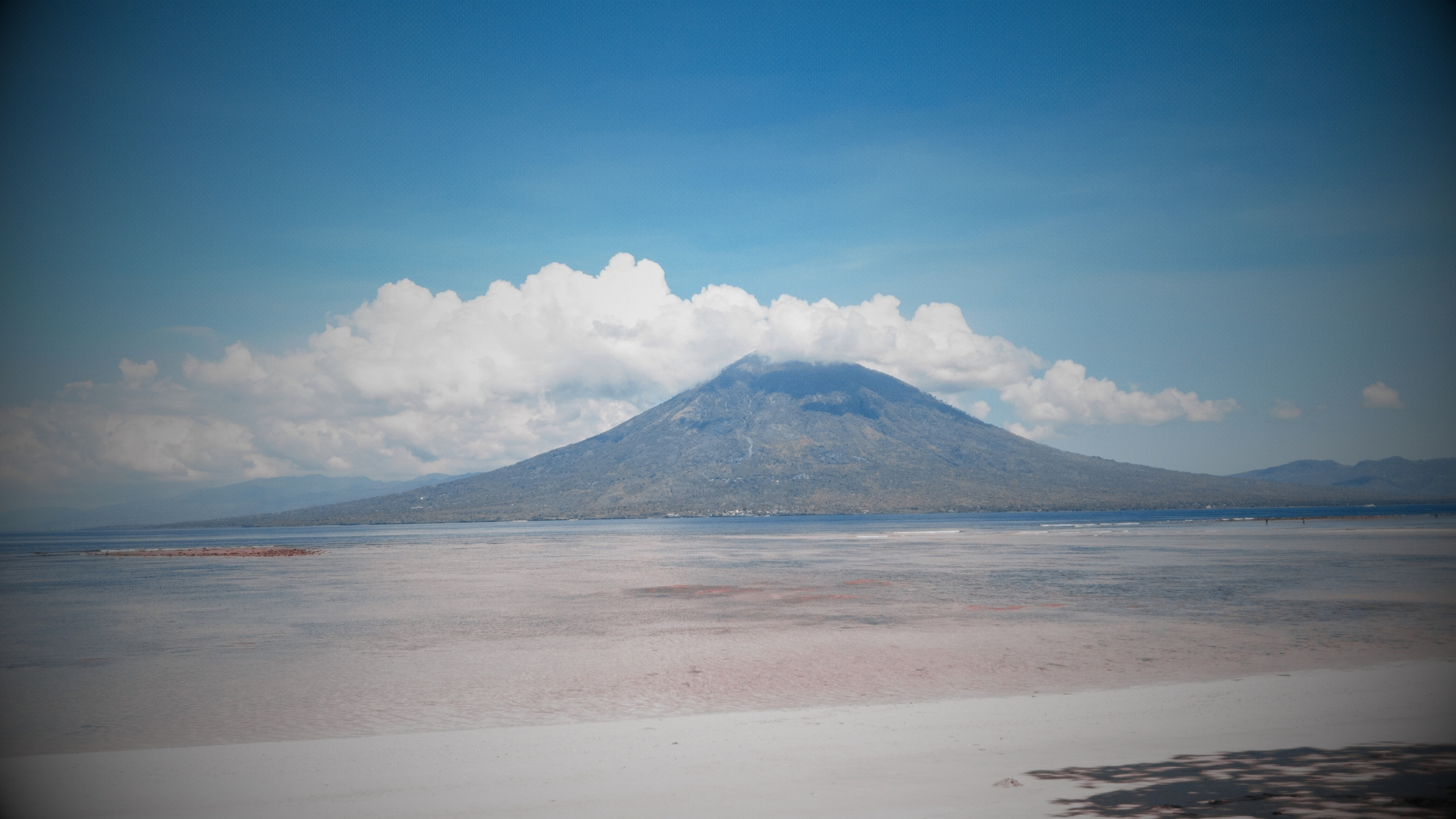
Lewotolok — also known as Lewotolo — is a stratovolcano on Lembata Island in Indonesia’s Lesser Sunda Islands.
The modern cone occupies the south-eastern side of the older Jambuluwuk volcanic structure. Its summit contains a crater about 400 metres across, while lava flows from historical and prehistoric activity extend across the flanks.
Its characteristic modern behaviour combines ash-rich explosions with Strombolian bursts, incandescent ejecta and occasional lava effusion — a volcano capable of being visually spectacular while posing serious proximal and downwind hazards.
1,431 mSummit elevation
StratovolcanoVolcano type
~400 mSummit crater width
PVMBGOfficial monitoring
Lewotolok quick facts
- Also known as
- Lewotolo
- Location
- Lembata, East Nusa Tenggara
- Volcano type
- Stratovolcano
- Summit feature
- ~400 m crater
- Official agency
- PVMBG / MAGMA
Activity and behaviour
Explosions, glowing ejecta and lava from the summit
Evergreen profile
How Lewotolok behaves
Lewotolok commonly produces ash-rich explosions and Strombolian bursts that throw incandescent material above the crater. Stronger phases can feed lava flows or avalanches of hot material on the upper slopes.
Check the latest verified status →Characteristic activityStrombolian burstsGas-driven explosions eject glowing scoria and bombs
Atmospheric hazardAsh plumesExplosive columns can drift well beyond the volcano
Effusive activityLava flowsHot lava can descend from the summit area
Proximal hazardBallistic ejectaBombs and blocks fall around the active crater
Official sourcePVMBG / MAGMAAuthoritative monitoring and hazard guidance
The spectacle is also the hazard
Glowing ejecta can travel well beyond the vent
Strombolian explosions are often visually dramatic, especially at night, but the incandescent fragments are ballistic projectiles. Close to the summit they can cause severe injury, while ash and gas affect a much wider area.
Volcanic architecture
Lewotolok grew inside an older volcanic landscape
The present cone sits within the older Jambuluwuk structure. That relationship records more than one stage of volcano building: an older edifice was modified by collapse and erosion, before the younger Lewotolok cone became the dominant eruptive centre.
Older structureJambuluwuk forms part of the inherited volcanic landscape.
Younger coneLewotolok rose within the older edifice.
Summit craterA roughly 400-metre-wide crater focuses modern activity.
Lava-covered flanksFlows record repeated effusive activity.

How Lewotolok erupts
Gas bursts turn rising magma into fountains of fragments
Gas bubbles grow as magma rises and pressure falls. When those bubbles burst at the vent they can throw incandescent scoria, bombs and ash above the crater in repeated Strombolian explosions.
If magma supply is sufficient, lava may also spill from the summit area and move downslope. Lewotolok can therefore combine explosive and effusive behaviour within the same eruptive period.

Monitoring
Watching explosions, tremor, lava and ash together
PVMBG uses seismic instruments, visual observations and remote sensing to follow Lewotolok. Changes in explosion frequency, tremor, plume height and incandescent activity help reveal shifts in the eruptive system.
A volcano through time
Lewotolok eruption timeline
1660
Earliest recorded eruption
Historical records describe explosive activity from Lewotolok.
1819
Renewed activity
Another documented eruptive episode adds to the volcano’s historical record.
1920
Twentieth-century eruption
Explosive activity was again reported from the summit.
1999
Short explosive episode
A brief eruption produced ash from the summit area.
Major modern reawakening2012
Unrest prompts evacuation
Increased seismicity and observations of the volcano led to heightened concern and precautionary evacuation, although no major eruption followed.
Long-running eruption2020–present
Persistent explosive and effusive activity
A powerful eruption in late 2020 began the current prolonged period, with repeated ash explosions, Strombolian activity, incandescent ejecta and lava flows.
Hazards
Lewotolok’s main hazards
Fine ash can affect health, water supplies, crops, visibility and machinery.
Bombs and blocks are dangerous around the active summit.
Effusive activity can send hot lava down upper and middle slopes.
Unstable incandescent material can move rapidly downslope.
Gas concentrations can become hazardous near the crater and plume.
Explosive plumes can affect aircraft routes around the Lesser Sunda Islands.
Myths versus reality
Strombolian does not mean harmless
Ballistic ejecta can travel beyond the vent and is potentially lethal.
Effusion and explosive activity can occur during the same eruptive phase.
Explosion frequency, ash output and lava activity can all change.
Volcoholics insight
Lewotolok shows that explosive and effusive activity are not opposites
The same summit system can throw incandescent fragments into the air while feeding lava onto the slopes. Lewotolok’s behaviour is a reminder that volcanic eruptions rarely fit into neat boxes: gas, ash and flowing magma can all be part of the same evolving event.
Questions answered
Lewotolok explained
Where can I find Lewotolok’s latest official status?
Use the Volcoholics volcano directory for the latest verified summary, then follow PVMBG / MAGMA Indonesia for authoritative alert levels, bulletins and exclusion guidance.
Is Lewotolok also called Lewotolo?
Yes. Both names are used for the volcano on Lembata Island.
What type of volcano is Lewotolok?
It is a stratovolcano built within an older volcanic structure associated with Jambuluwuk.
What is Strombolian activity?
It is an eruptive style in which gas bursts eject incandescent fragments, bombs and ash from a vent in repeated explosions.
Who monitors Lewotolok?
Indonesia’s PVMBG provides official monitoring and public hazard information through MAGMA Indonesia.
Official science, made readable
Built from the agencies watching Lewotolok
This evergreen profile uses PVMBG / MAGMA Indonesia reporting and Smithsonian Global Volcanism Program records as its factual basis. Permanent geology, eruption style, hazards and history are kept separate from today’s operational status.
PVMBG / MAGMA IndonesiaOfficial Indonesian volcano monitoring, bulletins and hazard guidance.
Smithsonian Global Volcanism ProgramLong-term eruption chronology, morphology and geological reference information.